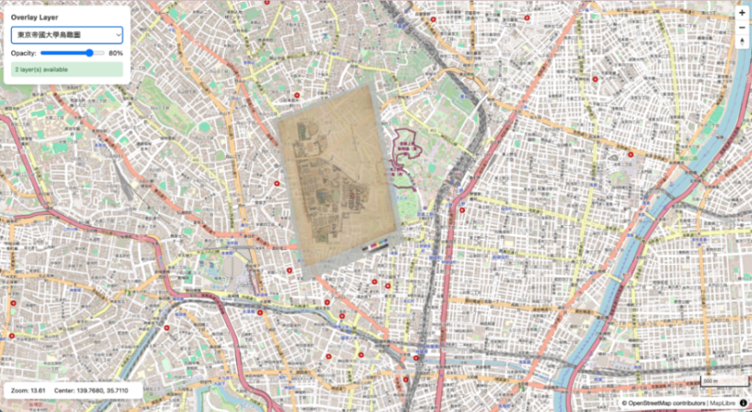
Serving IIIF Images via Web Tile Map Service
This article summarizes the procedure for generating XYZ tiles from IIIF Georeference Extension JSON, serving them with TileServer GL, and displaying them with MapLibre GL JS. Aerial view of the University of Tokyo overlaid on OSM Overview IIIF Georeference JSON | v +------------------------+ | iiif-georef-tiles | | (XYZ tile generation) | +------------------------+ | v +------------------------+ | mb-util | | (mbtiles conversion) | +------------------------+ | v +------------------------+ | TileServer GL | | (tile serving) | +------------------------+ | v +------------------------+ | MapLibre GL JS | | (map display) | +------------------------+ Requirements Docker / Docker Compose Python 3.x GDAL (gdal_translate, gdalwarp, gdal2tiles.py) Pillow (pip3 install pillow) mb-util Installing GDAL # macOS (Homebrew) brew install gdal # Ubuntu/Debian sudo apt install gdal-bin python3-gdal Installing mb-util pip3 install mbutil 1. Project Structure wtms/ ├── docker-compose.yml ├── data/ # mbtiles files ├── styles/ # Custom styles (optional) ├── frontend/ # MapLibre viewer └── docs/ 2. Docker Compose Configuration docker-compose.yml: ...
